


Data Collection Services

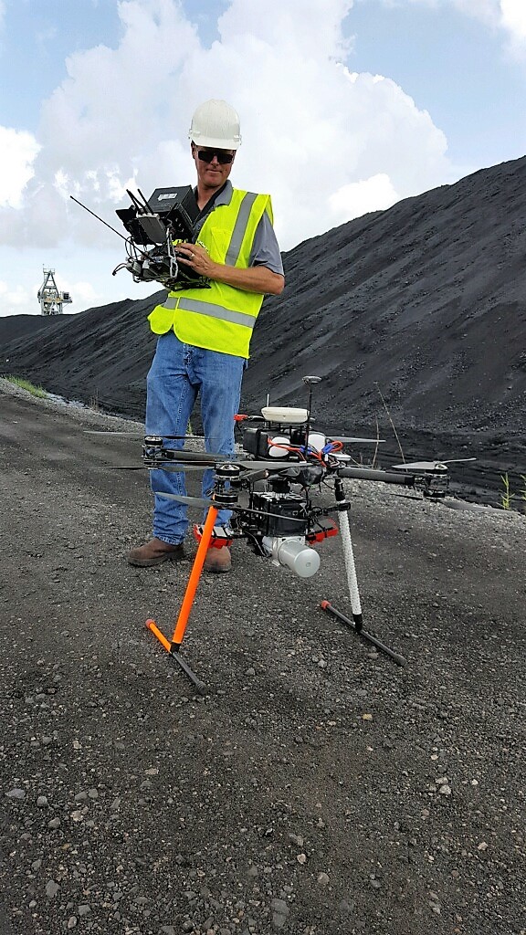
Our data collection services cut days of traditional survey work in to hours. Proprietary survey and inventory methods combined with our custom UAV platforms provide greater accuracy and far more detail than previously possible. Using McCord’s UAV platforms for data collection services allows sensors and high-resolution cameras a vantage point for the most complete information and imagery available. Our data is not subject to the same limitations in access as ground-based data collection services. At McCord Geospatial Services, we continue to grow our fleet, develop new technologies and add modern sensors to collect valuable data. McCord’s team of experienced utility industry professionals and FAA licensed pilots are dedicated to applying state-of-the-art technologies to produce high-quality deliverables for our clients.
Our objective is to provide highly refined and accurate data to our clients about their facilities in the field in order to support specific business decisions and objectives. While many other firms are working toward diversifying their services across multiple industries, at McCord Geospatial Services, we are staying focused on developing the best possible data collection services and resources for utility and surveying industries.
Contact our data collection services team today for a quote.


Power Line Engineering / NERC Compliance
The data collected from our multiple sensors paints a great picture of what is actually out in the field. The combination of LiDAR and data from our on-site weather stations creates a very accurate model of existing attachment heights and sag conditions of conductors. Once this information is integrated into our PLS-CADD design software, the result is the most accurate power line engineering product at a very economical rate to our clients.
Vegetation Management
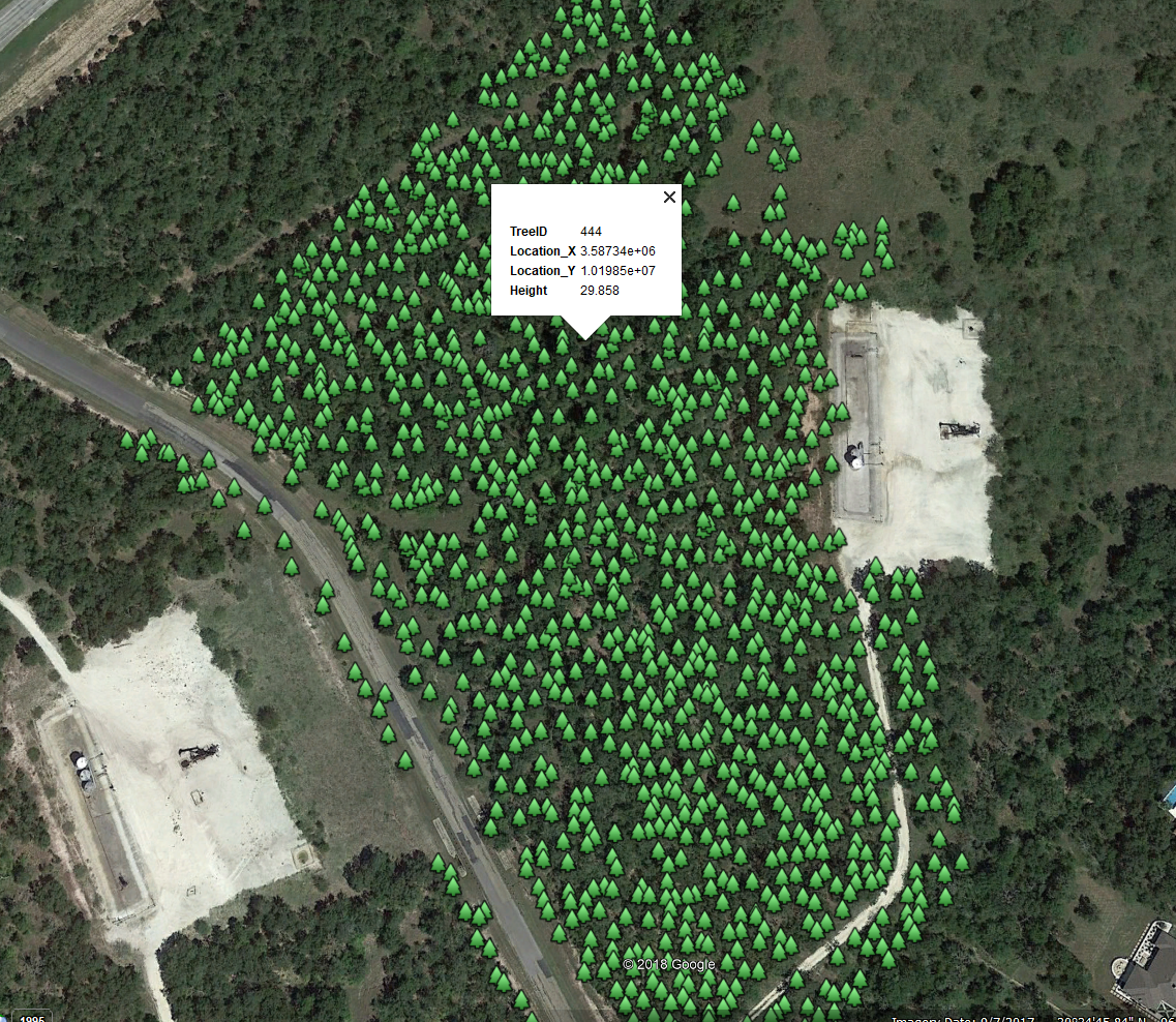
Using a combination of LiDAR, images, video and NDVI cameras, our team gathers the data necessary to run a highly accurate vegetation analysis. With this data, we can determine fall-in and grow-in violations, height of vegetation, identify dead or unhealthy trees and more.
System Mapping
With a combination of sensors, we can map or update mapping on existing power line systems. Our techniques allow us to obtain precise coordinates of pole locations and gather asset information through images and video. The collected information can also be used to obtain communication attachment data.
Substation Surveys
By gathering data with our LiDAR sensor, FLIR and high-resolution cameras, we are able to deliver valuable as-built information to our customers. If you are planning a new substation, our team can gather centimeter grade survey data to assist in site design.
Utility Structure Inspections
Our UAV’s equipped with FLIR infrared and high-resolution imagery provide our team with the necessary data to perform a quality visual inspection of facilities. This approach results in a safer work environment completed at a lower cost than traditional means.
Communication Tower Inspections
Traditionally, towers are inspected by climbing the structures and taking photos and notes along the way. With today’s technology, we are able to collect high-definition images and video as well as lidar and infrared. This creates a much safer environment with more accurate data. We can deliver this data in user-friendly viewing software. Imagine a georeferenced map showing all tower locations; inside each tower location, you can view and measure the most up-to-date data at each location.
Disaster Management
In the event of a disaster, MEI stands equipped and ready to help assess the situation and deliver the results in a timely manner. Our UAV’s are capable of collecting photo/video feed and broadcasting real-time information back to a command center. This helps expedite the remediation process, as well as provide information for media outlets and critical insurance documentation. McCord Engineering’s UAV Program was originally developed for our in-house engineering needs as well as a service to our existing clients in the electric utility industry. Our core business remains focused on serving the core business of our utility clients. Our UAV’s and the sensors mounted on them also produce a great product for a number of other applications including:
- Proposed Corridor Surveys
- Pipeline Right-Of-Way Inspections
- Photo/Video Shoots
- Construction Site Inspections
- Insurance Inspections
- Volumetric Surveys
- Topographic Surveys
- As-Built Surveys
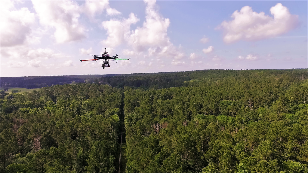
Utilizing an Unmanned Aerial Vehicle (UAV) platform for data collection sensors and high-resolution cameras provides a vantage point for the most complete information and imagery available, and it is n
ot subject to the same limitations in access as ground-based data collection. Data that once took days to obtain through traditional survey and inventory methods is now gathered in a matter of hours with greater accuracy and far more detail.
UAV Sensors
- LiDAR
- 700,000 measurements/second
- Highly accurate 3D data for any measurement or analytical need
- For tough or large surveying areas, under trees, along bodies of water
- FLIR Infrared
- Radiometric data for post-processing
- Geotagged thermal inspections
- Infrared mosaics of buildings
- 4K Video
- Inspections
- Live Viewing
- High Resolution Still Cameras
- Geotagged for inspections
- Mosaics
- Normalized Difference Vegetation Index (NDVI)
- Vegetation analysis and vegetation management
- Creating mosaics and colorizing LiDAR
In most cases, all sensors can collect data simultaneously in one flight. This creates a series of data that can be used for many different applications. For more information on our Unmanned Aerial Vehicles click HERE.
Our team will determine the best method of data collection to deliver the most accurate product at the lowest cost to our clients.
- Unmanned Aerial Vehicle (Drone)
- Terrestrial LiDAR (Vehicular/Pedestrian)
- Stationary LiDAR
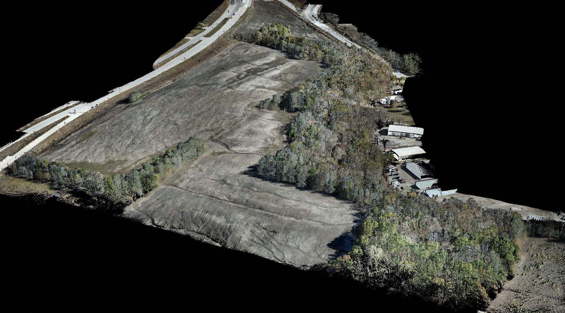
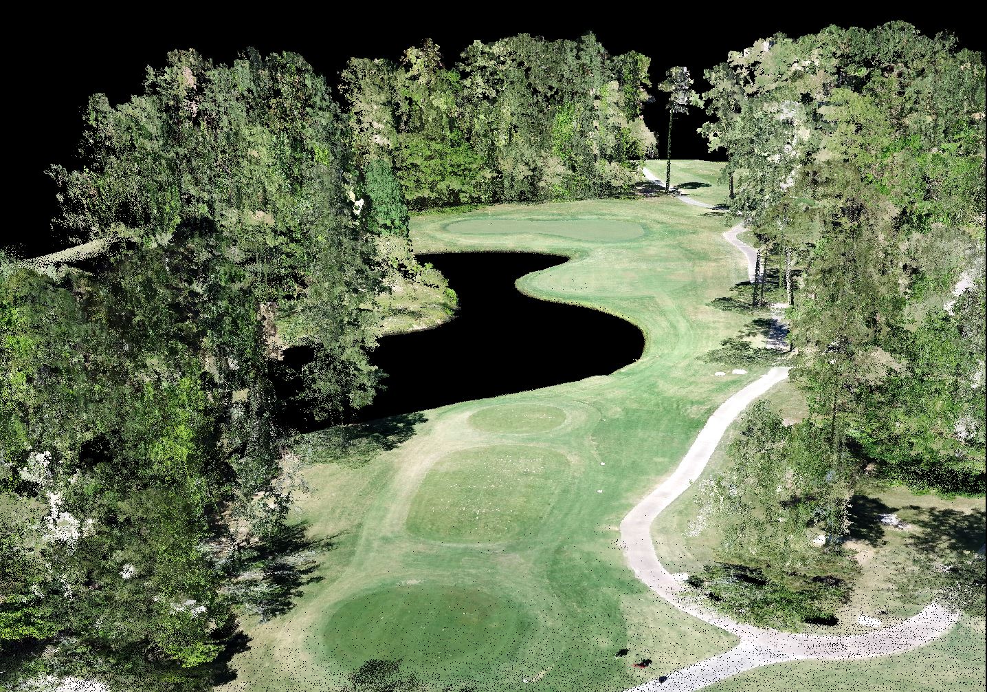
With drone surveying, McCord Engineering Geospatial Services can collect high-density LiDAR data used to create a 3D model. Data can be delivered to you in the form of topographical maps, point clouds, cross sections and mosaics; in a variety of file formats. This is especially helpful in hard-to-reach locations.
[Disclaimer: We are not licensed or certified surveyors/engineers. We are a data collection service that owns and uses cutting-edge technology to save your company time and money.]
Workflow:
- Define Job Area (.kmz files)
- Define Deliverables
- Point cloud
McCord Geospatial Drone LiDAR - DTM
- Mosaic
- Topography
- Cross-Sections
- Point cloud
- Confirm Property Permissions
- Check for COA Requirements
- Plan Mission
- Set Ground Control
- Fly Property
- Process Data
- Deliverables
- **Request Feedback to Refine Deliverables

We use high-res digital cameras for photogrammetry , and have a high-quality LiDAR. Either of these technologies give you accurate 3D measurements of surroundings you need mapped.
When we are finished, you get a full map, measurements of objects specified, and any files we created in collecting your data.
Give our professional drone surveying a try. Call us for more information and a demo of our data.

- Low-cost data collection
- High-density point clouds
- Drone point clouds allow for:
- All-inclusive orthomosaic of work area
- Fewer manual surveying points
- Precise measure of specific points
In addition, drone data allows for:
- Topographical mapping
- Watershed & flood analysis
- More precise line work for engineers
Drone surveying flyovers can help surveyors more precisely measure elements conventional surveying wouldn’t pick up without many hours of field labor. This in turn can help optimize procedures for saving money in equipment and man-hours.
McCord Engineering Geospatial Services does all the data collection for you. We handle the aircraft, insurance, FAA, etc. . . You show us the site, we’ll get you the data.
It is important to note we are not certified surveyors, nor do we do line work. We are simply another tool to help the industry collect more usable, more valuable data.
Drone LiDAR strengths?
We can fly over hard-to-reach locations and areas of heavy road traffic. We can help small companies obtain large projects and any company can use us for smaller areas. We can also penetrate heavy tree canopies, finding ground points in otherwise impossible to reach locations.
Drone LiDAR weaknesses?
Our LiDAR doesn’t penetrate water and it can’t map items buried underground.
What kind of density can we produce?
We collect 700,000 shots/sec. That produces a point density of 500 points per square meter, or 50 points per square foot.
What is our accuracy?
We have a 2cm horizontal and 5cm vertical accuracy. Total volumetric accuracy is within 3%.
How do you keep the accuracy?
With LiDAR or photogrammetry, we use ground control points for absolute point cloud positioning (we make sure the data matches your specs).
How do you check accuracy?
In addition to ground control points, we use visual landmarks and other known “check points” to verify accuracy within the point cloud.
Are Drones legal to use in commercial business?
The rules relative to drones in commercial business are changing on a regular basis. As a drone company it is part of our service to stay current on the FAA requirements for operation. As of the start of 2017, you can operate drones for business if you have:
- An FAA Exemption 333 or Part 107 license
- A registered “N-numbered” aircraft
- Appropriate COA, certificate of authorization for your flying location
- Permission from the owner or authorized agent of the property
Drones can be operated in most locations with what is called a “Blanket COA”. This COA is part of the 107 license. Some areas, such as close to airports require special authorization from the FAA. This authorization can take from a few days to a few weeks depending on the specific location.
There are many more details relating to the legal and safe operation of drones in US Airspace. We can provide more details upon request. The most important detail is it is completely legal to operate when you follow the appropriate FAA regulations.
Safety?
We operate at all times with our authorized Pilot and “Observer”. If the job warrants, we add extra crew members to keep needed areas clear and safe for flight.
The aircraft we use have several safety features in the case of technical issues during a mission.
We can supply further details upon request.
Liability?
McCord Engineering Geospatial Services carries at least $2 million in Liability insurance. If your company requires a specific level of insurance coverage we can make sure to match or exceed that level before starting work.
